Official tourism website for Northern Ireland
En

Moor Lough

Strabane, Co Tyrone
Moor Lough

Book Tickets Online

About

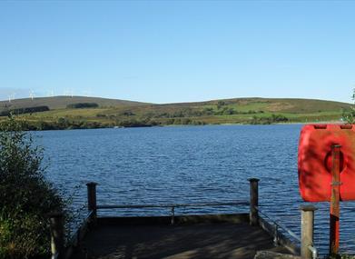
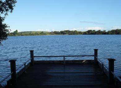
A quiet upland lake route in Strabane`s countryside

Start Point:
H445983

Finish Point:
H445983

Route:
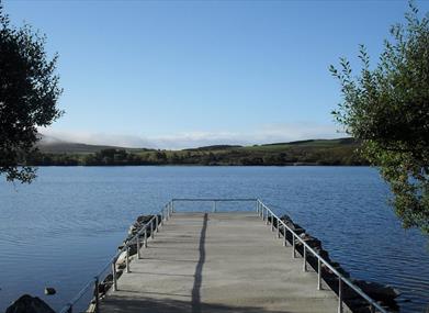
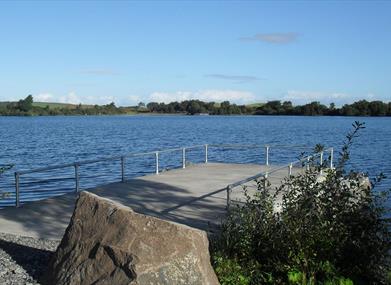
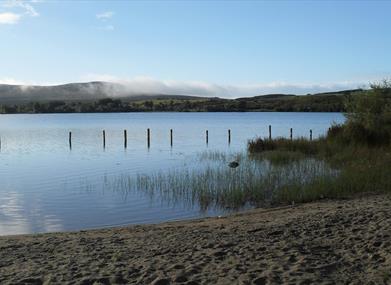
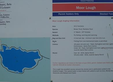
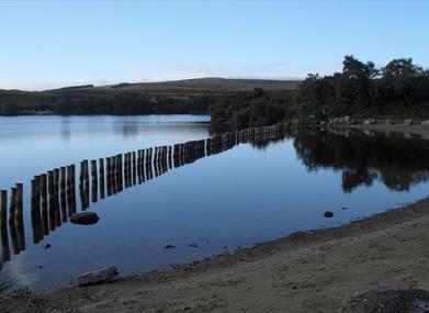
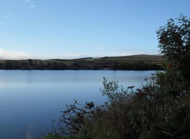
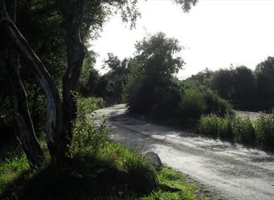
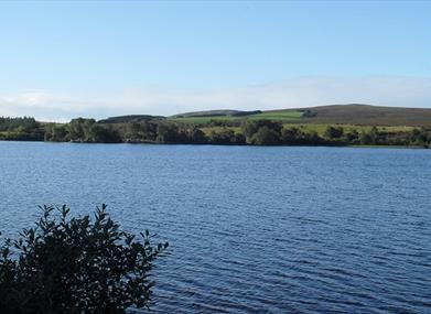
From the parking area beside the public toilets, follow the gravel path around the edge of the lough in either direction. Moor Lough and it`s shoreline have been developed as a Dept. of Culture, Arts and Leisure fishery. Moorlough has several beaches and a segregated paddling area available for use. A gravel track which circumnavigates the lough makes most of the shoreline accessible for all.

Distance:
1.2 miles

Terrain:
Gravel track, some potholes

Point of interest:
Moor Lough and surrounding glacial landscape.

Facilities:
Toilets between April and October, disabled fishing stands

Nearest town:
Strabane

OS map:
12

Accessible toilet facilities:
Yes

Accessible terrain:
Grade 3

Accessible signage:
None

Book Tickets

Facilities

Provider Preferences

  • Free (parking charges may apply)

Map & Directions

What's Nearby

  1. This well preserved and unusual monument is in an extensive area of blanket peat near the…

    3.52 miles away
  2. The Alley Arts and Conference Centre is a theatre complex, art gallery, visitor…

    6.28 miles away
  3. Sion Stables is a visitor attraction located in the historic linen village of Sion Mills…

    7.23 miles away
  4. The power of the O’Neill chieftains in Tyrone came to an end in 1607. Defeated in battle…

    8.24 miles away
  5. Thought to have been built around 1320 by a local chieftain of the O’Neill clan, but…

    8.82 miles away
  6. Set in the Burntollet Valley within Ness Country Park, this nature reserve provides the…

    9.06 miles away
  7. In the steep, wooded Glen of the Burntollet River, south-east of Derry/Londonderry, lies…

    9.78 miles away
  8. There are over 10km of walking trails, a 6km scenic drive, wildfowl enclosure and deer…

    10.43 miles away
  9. Explore the grounds & meet the farm animals. Come and take a walk through history as you…

    10.43 miles away
  10. The Archive and Genealogy Service of Derry City Council has responsibility for the…

    11.04 miles away
  11. In the grounds of the Long Tower Church, the Áras Cholmcille or St. Columba Heritage…

    11.26 miles away
  12. Dominating the skyline on all approaches to the city of Derry~Londonderry is Saint…

    11.28 miles away
  13. The Verbal Arts Centre is an educational charity founded in 1992 and now located in the…

    11.28 miles away
  14. Derry~Londonderry is the only remaining completely walled city in Ireland and is one of…

    11.34 miles away
  15. Get yourself down to Badger's Bar where you'll find the infamous Derry Girls mural, one…

    11.36 miles away
  16. A neo-Gothic church of 1872. built of whinstone with sandstone dressings. Iit is…

    11.37 miles away

Virtual Tour

Map & Directions

Road Directions

Follow the A5 Strabane Londonderry Road north from Strabane and turn right onto the B49 Woodend Road, Artigarvin and Donemana are signposted this way. In Artigarvin, turn right onto the Moorlough Road. Continue along this road passing through the small village of Glenmornan after 3km. Continue along this road for another 2.5km, then turn right onto the Napple Road. After 500m turn left onto the Hollyhill Road, which will lead you to the parking area at Moor Lough.

Public Transport Directions

Translink - journeyplanner.translink.co.uk

Back to Top

Tourism Northern Ireland

Don't Miss