Official tourism website for Northern Ireland
En

Broad Water

Co Down
Broad Water

Book Tickets Online

About

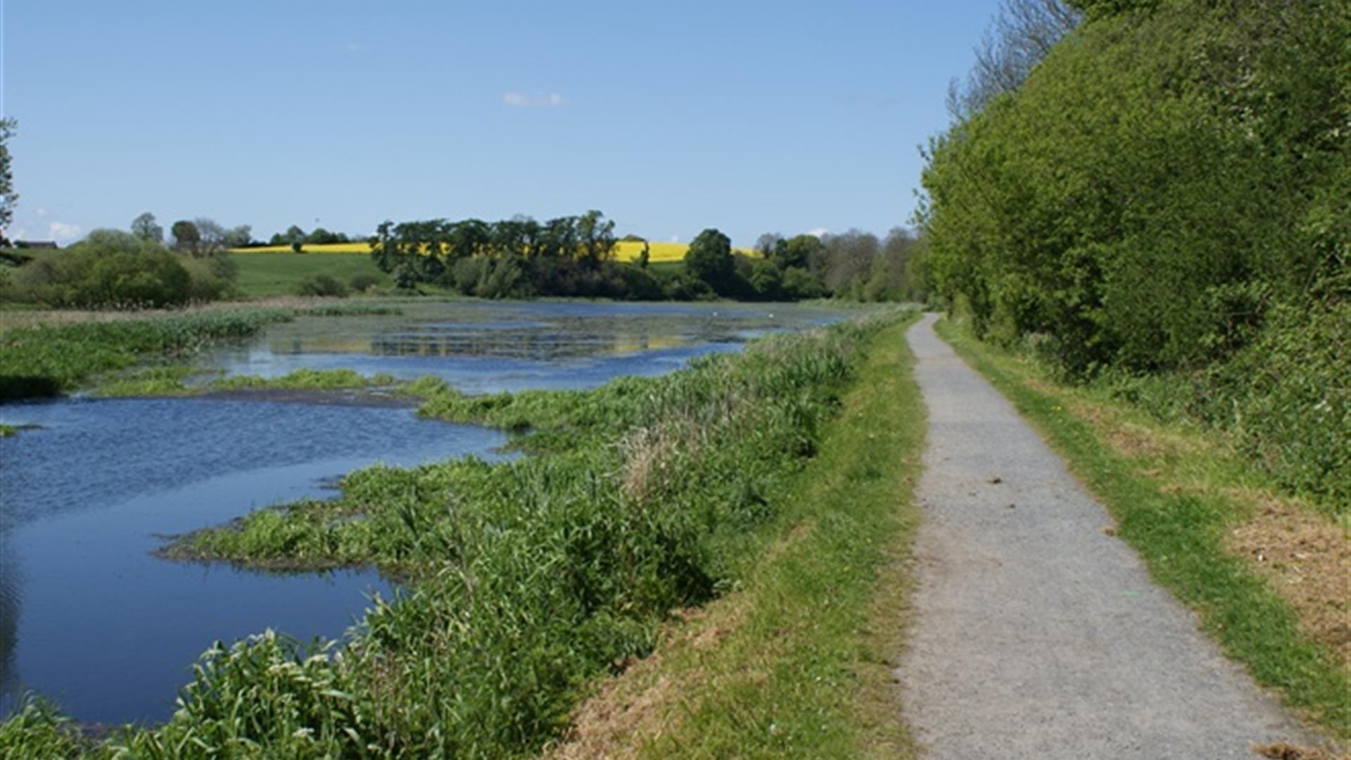
The Broad Water is a 3 mile (4.8km) towpath walk between Moira Railway Station and Aghalee and takes you along the route of the original Lagan Canal through Soldierstown. Keep an eye out for the large variety of breeding and wintering wildfowl.

Since the canal was officially abandoned in 1954 the banks have become overgrown and an array of colour is provided by a variety of trees, shrubs and wild flowers. Moira is unique as being the only town in Ireland to straddle two counties, County Down and County Armagh

The Broad Water is a man made feature, built in a natural valley in order to retain a sufficient head of water to accommodate the navigation. Take a seat and enjoy the sights and sounds of nature, set against the background of a thin belt of mature woodland!

Start Point:
J157618

Finish Point:
J124649

Route:
Begin walking from the entrance located in the car park of Moira Railway Station. Passing under the bridge that carries the railway line which was built in 1833, stop to have a look at the unusual “skew brickwork” used to add strength to the bridge and how the strain of the tow rope cut notches in the iron guard at the foot of the bridge. Further along after passing the car park and picnic tables at Soldierstown Car Park you come to a large expanse of water, known as the Broad Water. Look out for the Soldierstown Church up on your left, where the engineer responsible for the Lisburn-Lough Neagh section of the canal, Richard Owen, was buried in 1830. On reaching the top end of the main Broad Water you will see the former bank-ranger’s house however this is now privately owned. The final part of the walk will take you into the Village of Aghalee. For those who wish to continue their journey towards Lisburn, then you can either take the train from Moira Railway Station or simply follow small country back roads, joining the towpath of the Lagan Valley Regional Park at Union Locks, Blaris Road, Lisburn.

Distance:
3 miles

Terrain:
Flat towpath

Point of interest:
Soldierstown Church & Graveyard

Facilities:
Car parking available at Soldierstown. Refreshments available in Moira.

Publication:
None

Publication availability:
n/a

Nearest town:
Moira Village

OS map:
Sheet 20

Accessible terrain:
Flat tarmac path

Book Tickets

Facilities

Provider Preferences

  • Free (parking charges may apply)

Map & Directions

What's Nearby

  1. Moira Demesne is a parkland offering beautiful walks, picnic sites and a children's play…

    0.85 miles away
  2. A unique array of historic aircraft and exhibits celebrating Northern Ireland’s aviation…

    4.03 miles away
  3. From school groups, to community associations and corporate guests, the Coca-Cola…

    4.54 miles away
  4. Lurgan Park is the second largest public park in Ireland, and is enjoyed by as many as…

    4.9 miles away
  5. Brownlow House is Located in the centre of Lurgan adjacent to Lurgan Public Park, a grade…

    4.96 miles away
  6. Come and explore Northern Ireland's royal residence, where worlds and minds meet. Relax…

    5.24 miles away
  7. For those who enjoy the outdoors, a visit to the RSPB’s reserve at Portmore Lough is a…

    5.43 miles away
  8. The Courthouse was originally a Georgian market house built before 1765. It was used as a…

    5.6 miles away
  9. The looped walk around the forest lake is a popular choice among bird-watchers, dog…

    5.72 miles away
  10. Owned by Historic Royal Palaces, Hillsborough Fort was constructed in the 17th Century,…

    5.73 miles away
  11. The Ballance House farm museum, run by The Ulster New Zealand Trust, is the restored…

    6.07 miles away
  12. Dromore Mound or Dromore Motte and Bailey as it is commonly known is the best preserved…

    6.13 miles away
  13. Gardens around this Georgian farmhouse. Experience old Irish gate, tree and sculpture…

    6.7 miles away
  14. Enjoy four miles of footpaths, five birdwatching hides, woodland, ponds, wildflower…

    6.79 miles away
  15. Oxford Island National Nature Reserve is a peninsula created by successive lowering of…

    6.89 miles away
  16. The Irish Linen Centre & Lisburn Museum is an award-winning museum located in Market…

    6.96 miles away

Virtual Tour

Map & Directions

Road Directions

A pedestrian entrance to the Broad Water is available from the car of Moira Railway Station, Station Rd, Moira. A car park, picnic tables and link to the towpath are located at Soldierstown Car Park on the Soldierstown Road approximately midway between the villages of Moira and Aghalee. In addition the route can also be accessed in Aghalee Village from Soldierstown Road.

Public Transport Directions

Translink - journeyplanner.translink.co.uk

Back to Top

Tourism Northern Ireland

Don't Miss