Official tourism website for Northern Ireland
En

Cranfield West Beach

Cranfield, Kilkeel, County Down, BT34 4LN
Cranfield West Beach

Book Tickets Online

About

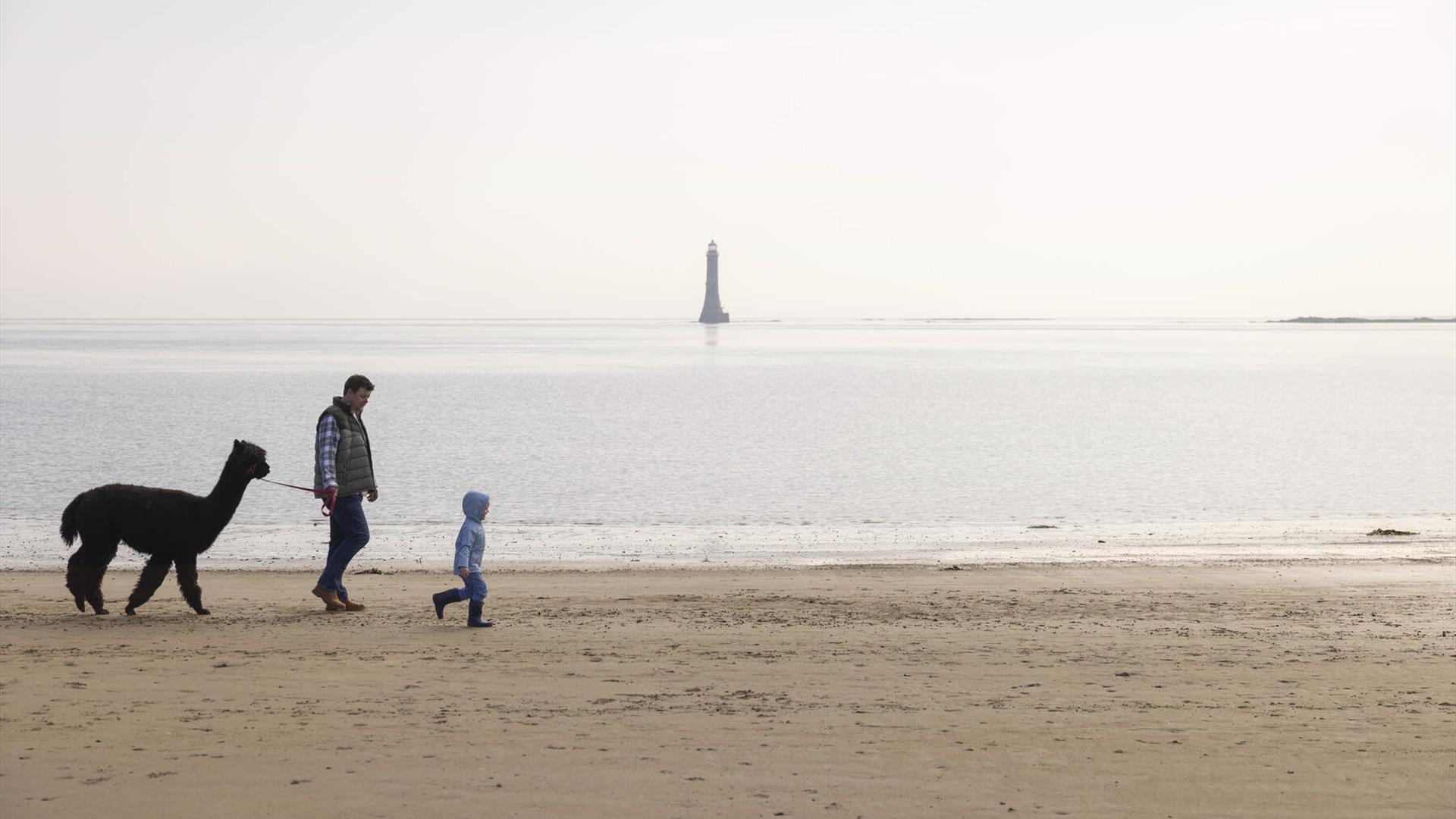
Cranfield West offers a gently sloping, mainly sandy beach located at the entrance to Carlingford Lough, an area designated as being of Special Scientific Interest. Set in an idyllic location at the mouth of Carlingford Lough in County Down, this south facing beach boasts the majestic Mourne Mountains as a backdrop.

Facilities include parking, children's play area, toilets and showers.

Lifeguard supervision July - August daily 11am - 6pm and September weekends only.

Cranfield Beach is an inclusive beach, run in partnership with Mae Murray Foundation, which allows people of all ages and abilities to take part, have fun, and be included. Inclusive beaches offer free beach equipment loan schemes including all-terrain wheelchairs and mobility aids. Membership is free and available via the Mae Murray Foundation.


Book Tickets

Guide Prices

Ticket TypeTicket Tariff
TicketFree

Note: Prices are a guide only and may change on a daily basis.

Explore More

Tyrella Beach, CloughTyrella beach and conservation area is a small, enclosed dune complex within Dundrum Bay. It is a wide, flat, sandy beach two kilometres long and backed by 25 hectares of mature dunes in a conservation area.

Mourne Gullion Strangford Geopark, Northern IrelandMourne Gullion Strangford Geopark is a UNESCO Global Geopark and recognised Area of Outstanding Beauty that seamlessly blends stunning landscapes, rich geological history, and vibrant cultural heritage.

Tripadvisor Traveller Rating

Tripadvisor Traveller Rating - 120 reviews120 reviews

Add Cranfield West Beach to your Itinerary

Close window

Call direct on:

Tel+44 (0) 330 137 4046

Map & Directions

Opening Times

* Lifeguard supervision July - August daily 11am - 6pm and September weekends only.

What's Nearby

  1. Commanding the mouth of Carlingford Lough, the Castle has an eventful history. It was…

    1.29 miles away
  2. Provides a first class service for visitors to Northern Ireland and for local residents.

    3.72 miles away
  3. The Nautilus Centre overlooks Kilkeel's busy and picturesque fishing port and houses the…

    3.72 miles away
  4. Kilbroney Park Forest features riverside walks and an arboretum. There is a two-mile…

    6.67 miles away
  5. The Silent Valley Reservoir was built to gather water from the Mourne Mountains and is…

    6.94 miles away
  6. 'Cill Bhronaigh', or Bronagh’s Church (12th century), is located in the graveyard just…

    7.23 miles away
  7. Our play farm offers a huge indoor soft play area with four dragon slides and a massive…

    8.7 miles away
  8. Annalong Cornmill has been beatifully restored and is situated by the pretty Annalong…

    8.92 miles away
  9. "Where the Mountains of Mourne sweep down to the sea" (Percy French) The popular song has…

    9.39 miles away
  10. Excellent example of a tower-house and bawn built about 1568 at a point where the Newry…

    10.15 miles away
  11. Spelga Dam Reservoir sits in the heart of the Mourne Mountains, located approximately 10…

    10.33 miles away
  12. Known locally as the ‘King’s Ring’, this court tomb has a prominent position in the…

    11.6 miles away
  13. Goward Dolmen is situated approx 0.4km south of the B8 Castlewellan/Hilltown road on the…

    12.69 miles away
  14. Kilnassagart Inscribed Stone, in the south of County Armagh, is regarded as being one of…

    12.82 miles away
  15. South of the County Armagh village of Jonesborough lie the ruins of Moyry Castle, built…

    13.04 miles away
  16. Covering an area of almost 630 hectares at the foot of the Mourne mountains, Tollymore…

    14.45 miles away

Explore More

Tyrella Beach, CloughTyrella beach and conservation area is a small, enclosed dune complex within Dundrum Bay. It is a wide, flat, sandy beach two kilometres long and backed by 25 hectares of mature dunes in a conservation area.

Mourne Gullion Strangford Geopark, Northern IrelandMourne Gullion Strangford Geopark is a UNESCO Global Geopark and recognised Area of Outstanding Beauty that seamlessly blends stunning landscapes, rich geological history, and vibrant cultural heritage.

Virtual Tour

Map & Directions

Road Directions

Directions from Town:

The nearest town is Kilkeel, located approximately 4 miles from the beach. Access routes are clearly signposted from the main Rostrevor to Kilkeel road.

Back to Top

Tourism Northern Ireland

Don't Miss