Official tourism website for Northern Ireland
En

Meelmore and Meelbeg

Co Down
Meelmore and Meelbeg

Book Tickets Online

About

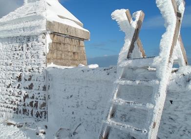
A moderate circular walk in the High Mournes, summiting two of the seven highest peaks in the region, Slieve Meelmore and Slieve Meelbeg.

Start Point:
J279279

Finish Point:
J279279

Route:
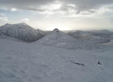
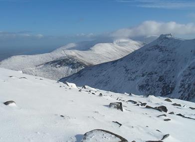
Cross the obvious stile on the opposite side of the road from Ott car park. After 150m the stony track splits in two - take the upper path and continue along the obvious track ascending to the col between Slieve Loughshannagh and Carn Mountain where you will meet the Mourne Wall. At the wall turn left and follow the Mourne Wall up the summits of Slieve Loughshannagh (619m) and Slieve Meelbeg (708m), up to the summit of Slieve Meelmore (687m). Retrace your steps 300m back down Slieve Meelmore to the wall intersection and descend into the valley using the right hand wall at this intersection. Continue to where the wall meets a walking track and river and follow the river downstream, following the walking trails on either side. At the bottom of the valley pick up the Ulster Way, before reaching a pocket of evergreen woodland, follow this in a south westerly direction passing Fofanny Dam after 750m. The Ulster Way emerges onto the Slievenaman Road. Turn left and continue for 800m along the road back to Ott car park.

Distance:
5.5 miles

Terrain:
Unsurfaced tracks, mountain path

Point of interest:
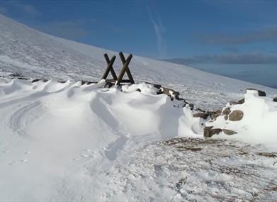
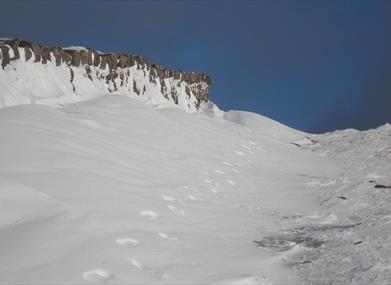
Slieve Loughshannagh, Slieve Meelbeg, Slieve Meelmore, Fofanny Dam, the Mourne Wall

Facilities:
Car park and picnic facilities available at Ott car park.

Publication:
None.

Nearest town:
Hilltown

OS map:
29

Accessible terrain:
no

Accessible signage:
no

Book Tickets

Facilities

Provider Preferences

  • Free (parking charges may apply)

Map & Directions

What's Nearby

  1. Goward Dolmen is situated approx 0.4km south of the B8 Castlewellan/Hilltown road on the…

    2.96 miles away
  2. The Silent Valley Reservoir was built to gather water from the Mourne Mountains and is…

    4.56 miles away
  3. Covering an area of almost 630 hectares at the foot of the Mourne mountains, Tollymore…

    4.88 miles away
  4. "Where the Mountains of Mourne sweep down to the sea" (Percy French)
    The popular song has…

    4.97 miles away
  5. Castlewellan Peace Maze, is one of the world's largest permanent hedge mazes representing…

    6.2 miles away
  6. Castlewellan Forest Park boasts a stunning Victorian Castle, incredible panoramic views,…

    6.32 miles away
  7. Sand & pebble beach located on the south down coast.

    6.54 miles away
  8. Maghera Church and Round Tower is of major historical importance and is among many…

    6.86 miles away
  9. The fertile land of County Down has been farming country for centuries. It was here that…

    6.88 miles away
  10. 'Cill Bhronaigh', or Bronagh’s Church (12th century), is located in the graveyard just…

    7.73 miles away
  11. Annalong Cornmill has been beatifully restored and is situated by the pretty Annalong…

    7.8 miles away
  12. This 5 mile stretch of golden sands is still the essence of the resort and is hugely…

    8.09 miles away
  13. Murlough National Nature Reserve is a fragile 6000 year old sand dune system owned by the…

    8.35 miles away
  14. Provides a first class service for visitors to Northern Ireland and for local residents.

    8.56 miles away
  15. Kilbroney Park Forest features riverside walks and an arboretum. There is a two-mile…

    8.67 miles away
  16. The Nautilus Centre overlooks Kilkeel's busy and picturesque fishing port and houses the…

    8.68 miles away

Virtual Tour

Map & Directions

Road Directions

The walk starts at Ott car park. To get here follow the Kilkeel Road out of Hilltown for 7 km, turn left at the junction with Slievenaman Road and continue for 1.5 km, Ott car park is on the left hand side.

Public Transport Directions

Translink - journeyplanner.translink.co.uk

Back to Top

Tourism Northern Ireland

Don't Miss