


Book Tickets Online
About
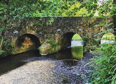
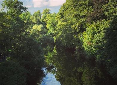
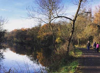
The Lagan Towpath takes the walker along the river and canal system through a variety of wetland, riverside meadows and mixed woodland from Belfast to Lisburn. Home to a variety of wildlife, the canal system dates back to the late 18th century and many features still give an insight into the majestic era of the lighter - the name for the boats that originally travelled on the Lagan Canal.Please Note: the towpath will be closed between the entrances at Lambeg Bridge and McIlroy Park from 7th May 2019 to the end of May 2019. This is to allow for essential repair work to be carried out on the towpath at Ballyskeagh Bridge. There will be cordons and notifications at the actual locations on the towpath.
Start Point:
J342712
Finish Point:
J264629
Route:
From Stranmillis, Belfast - go onto the tarmaced towpath with the river to your left. Continue for approximately 2kms. Cross the canal at Lock Keepers cottage (past red footbridge). At Shaws Bridge (old stone bridge), walk up the zigzag path to your left, cross the bridge taking you back to right hand side of the river. Continue with the river on your left until Drumbridge, here the path takes you over the river via a narrow footbridge and you can continue with the river and canal on your right till you reach Lagan Valley Island, Lisburn. The route takes you under the motorway via a walkway, under the sandstone Ballyskeagh bridge and crosses first the Tullynacross road and then the Hilden road. At Lagan Valley Island, cross the canal and keep alongside the river until you reach the road. To continue on towards Union Locks you will have to cross three roads using the crossings. When back on the river continue with river to your left for the final stretch to Union Locks. There is an option to extend the route from Stranmillis Weir, northwards to the Odyssey Complex where the River Lagan enters Belfast Lough. Upon reaching the weir at Stranmillis, bear left along the tarmac path to enter the car park at the popular local bar and eatery - 'Cutters Wharf'. After passing by Cutters Wharf and Queens Boat House on your right hand side, take the off road tarmac path to the right leading towards the river. Continue to follow this path under the bridge at Annadale Embankment. Follow the foot path along the river before reaching Kings Bridge at the Ormeau Road. The route continues along the edge of the river after crossing the Ormeau Road. Continue to follow this off road path until reaching Central Station. Upon reaching Central Station continue on the towpath with the river on your right, before reaching the main A20 East Bridge Street. Cross the road using the traffic lights and continue straight ahead onto Laganbank Road. After 100m, continue onto the river side path rather than bearing left onto Lanyon Place. Continue walking along the riverside path passing the Waterfront Hall on your left. Cross the A2 road using two sets of traffic lights, past ‘The Thanksgiving Statue’ or Nuala with the Hula as locals refer to this piece of modern metal sculpture, before reaching the pedestrian bridge adjacent to another piece of public art, ‘The Big Fish’. Cross the River Lagan using the pedestrian footbridge and bear left at the end of it to follow the path along the river, this time with it on your left. You will arrive at the Odyssey Arena on your right.
Distance:
11 miles
Terrain:
Off road quiet surfaced paths
Point of interest:
Historical canal, tranquil riverside habitats
Facilities:
Refreshments at Stranmillis; Cutters river grill and bar. Toilet and café facilities at Lock Keepers Cottage. Restaurant at Ramada Hotel, access from laneway opposite Lock Keepers Cottage. Refreshments and toilet facilities at Malone House, set in Barnetts Demesne above Shaws Bridge. Toilet and cafe facilities in Sir Thomas and Lady Dixon Park, follow paths from Drumbridge. Restaurant and toilet facilities at Lagan Valley Island, Lisburn.
Publication:
Towpath Leaflet, Lagan Valley Regional Park
Publication availability:
Available from local Tourist Information Centres, libraries or call 028 9049 1922
Nearest town:
Stranmillis, Belfast
OS map:
Sheets 15 & 20
Accessible toilet facilities:
Yes
Accessible terrain:
Tarmac path with road crossings
Book Tickets
Facilities
Provider Preferences
- Free (parking charges may apply)


