Official tourism website for Northern Ireland
En

Ballyquintin Point

8 Ballyquintin Road, Portaferry, County Down, BT22 1RG
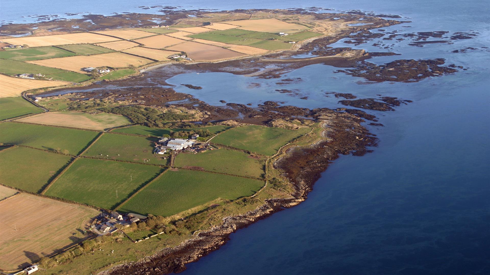
arial photo of part of the lough

Book Tickets Online

About

Ballyquintin Nature Reserve includes Ballyquintin Point at the tip of the Ards Peninsula, County Down where the Irish Sea enters Strangford Lough. This reserve lies on a low, exposed, rocky coastline but the point is formed by a raised beach of shingle and cobble stones caused by the last ice-age. It is a stunning location for walking and the the beautiful coastal path passes through beaches and farmland.

The point was formed by a raised beach of shingle and cobble stones, gently sloping inland to low cliffs. Such deep banks of raised beach shingle or vestiges from the last ice-age are found nowhere else around the Ulster coast. The thin soils support only sparse, dry grassland which briefly come to life in May and June with a colourful array and display of wild flowers. The patches of low-growing burnet raised flower are spotted here profusely from May to July and produce their unusual, purple hips soon after.

On a clear day, visitors can see across the Irish Sea to the Isle of Man, in addition to the usual sights of Strangford Lough and Killard Point.
Part of the site management is grazing by livestock and ponies so either leave dogs at home or keep them on a lead at all times.
There is several pubs restaurants and cafes to choose from in the nearby towns of Strangford and Portaferry.

Book Tickets

Facilities

Attraction Facilities

  • Open Evenings
  • Open Mondays
  • Open Sundays

Provider Preferences

  • Free (parking charges may apply)

Guide Prices

Ticket TypeTicket Tariff
TicketFree

Free

Add Ballyquintin Point to your Itinerary

Close window

Call direct on:

Tel+44 (0) 28 4461 5520

Map & Directions

Opening Times

* Open 24 hours a day, 7 days a week

What's Nearby

  1. The church at St Cooey’s Wells is thought to date from the 7th century but only the…

    1.22 miles away
  2. Kilclief Castle was built between 1413 and 1441, reputedly by John Sely, bishop of Down.…

    1.8 miles away
  3. Cloghy Rocks is a wonderful location as a number of seals are often spotted here. There…

    2.23 miles away
  4. Situated on the hill south east of the town below the stump of Portaferry Windmill, a lay…

    3.48 miles away
  5. Portaferry Castle is a 16th Century tower-house, built by the Savage family. It is…

    3.86 miles away
  6. Enjoy a diver's view of marine life from around the world without getting wet. An…

    3.88 miles away
  7. Discover a place of contrasts and creativity at Castle Ward, an eccentric 18th century…

    4.01 miles away
  8. Owned by the National Trust, it is a picturesque 18th century fishing village with scenic…

    4.12 miles away
  9. These ruined churches are situated one and a half miles north east of Portaferry on the…

    4.29 miles away
  10. The castle dates probably from around the 15th century, but the early history is unknown.…

    4.32 miles away
  11. Restored ruins of a sixth century church of St. Tassach, said to have given the last…

    5.48 miles away
  12. Within it are the ruins of a medieval church which is believed to be the Church of…

    5.99 miles away
  13. Struell Wells was built around a stream flowing through a secluded valley. It was a…

    7.16 miles away
  14. Two miles outside Downpatrick is the replica of St Patrick's first church in Ireland.…

    7.24 miles away
  15. The Centre consists of a small museum, numerous displays, a science education area, a…

    7.67 miles away
  16. Traditionally believed to have been built by Roland Savage of Ballygalget in 1622,…

    7.78 miles away

Virtual Tour

Map & Directions

Back to Top

Tourism Northern Ireland

Don't Miss