Official tourism website for Northern Ireland
En

Kilclief Castle

Shore Road, Strangford, County Down, BT30 7NP
Kilclief Castle

Book Tickets Online

About

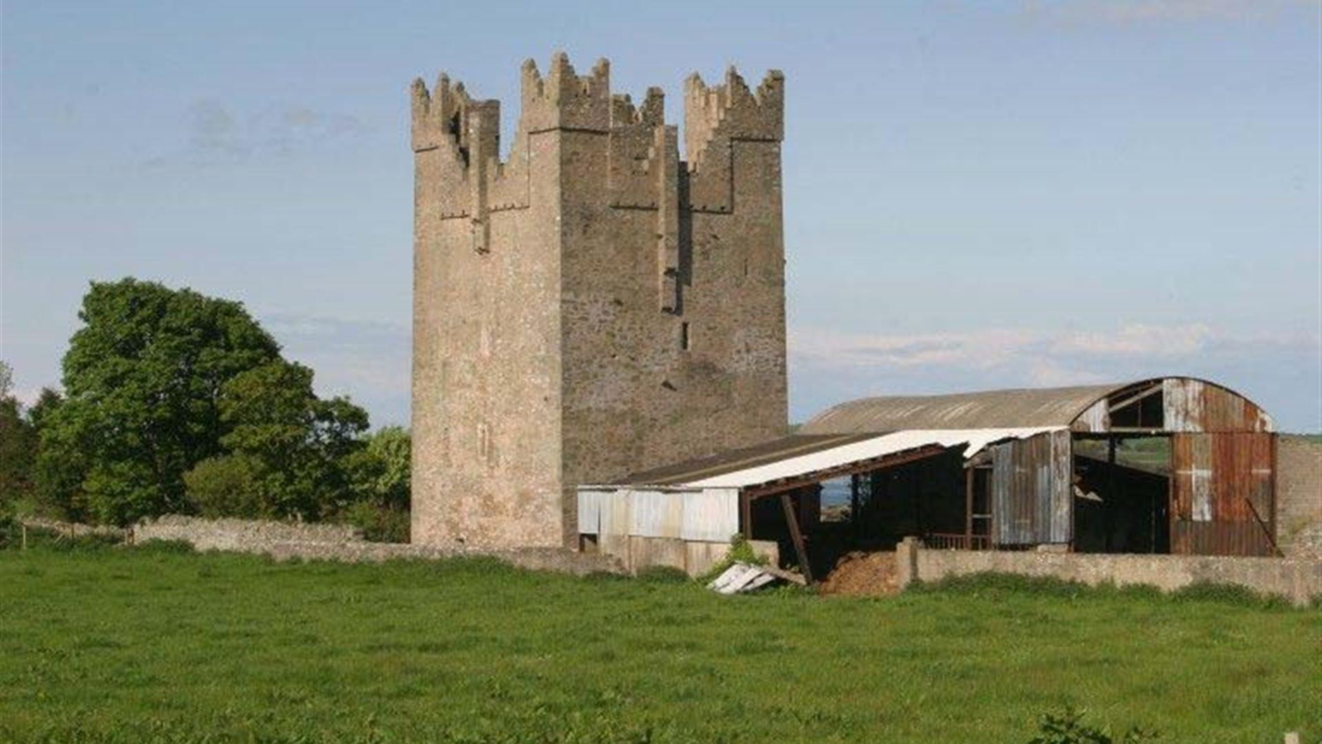
Kilclief Castle was built between 1413 and 1441, reputedly by John Sely, bishop of Down. This makes it the earliest datable tower-house in County Down and is often used to date other tower-houses in the County.

Features include a machicolation arch, projecting towers and spiral staircases. These unusual features may have been a blueprint for those at Ardglass, Strangford and various other sites.

The site is not suitable for disabled access.

No unaccompanied children under the age of 16.

Book Tickets

Guide Prices

Ticket TypeTicket Tariff
TicketFree

Admission Free.

Add Kilclief Castle to your Itinerary

Close window

Call direct on:

Tel+44 (0) 28 9082 3207

Map & Directions

Opening Times

* Closed for winter period. Summer opening times to be confirmed.

What's Nearby

  1. Cloghy Rocks is a wonderful location as a number of seals are often spotted here. There…

    0.88 miles away
  2. Ballyquintin Nature Reserve includes Ballyquintin Point at the tip of the Ards Peninsula,…

    1.8 miles away
  3. The church at St Cooey’s Wells is thought to date from the 7th century but only the…

    2.11 miles away
  4. Discover a place of contrasts and creativity at Castle Ward, an eccentric 18th century…

    2.65 miles away
  5. Situated on the hill south east of the town below the stump of Portaferry Windmill, a lay…

    2.96 miles away
  6. Portaferry Castle is a 16th Century tower-house, built by the Savage family. It is…

    3.18 miles away
  7. Enjoy a diver's view of marine life from around the world without getting wet. An…

    3.2 miles away
  8. The castle dates probably from around the 15th century, but the early history is unknown.…

    3.24 miles away
  9. Restored ruins of a sixth century church of St. Tassach, said to have given the last…

    3.74 miles away
  10. These ruined churches are situated one and a half miles north east of Portaferry on the…

    4.2 miles away
  11. Owned by the National Trust, it is a picturesque 18th century fishing village with scenic…

    4.96 miles away
  12. Struell Wells was built around a stream flowing through a secluded valley. It was a…

    5.4 miles away
  13. Two miles outside Downpatrick is the replica of St Patrick's first church in Ireland.…

    5.44 miles away
  14. Situated on the shores of Strangford Lough in an area of outstanding natural…

    6.2 miles away
  15. Mourne Gullion Strangford Geopark is a UNESCO Global Geopark and recognised Area of…

    6.21 miles away
  16. The Centre consists of a small museum, numerous displays, a science education area, a…

    6.23 miles away

Virtual Tour

Map & Directions

Road Directions

Directions from Town:
2.5 miles (4 km) south of Strangford on the A2 facing the sea. Car park opposite.

Back to Top

Tourism Northern Ireland

Don't Miss