Official tourism website for Northern Ireland
En

Croaghan Breen Forest Walk

28 Altarichard Road, Armoy, County Antrim, BT53 8XT
Croaghan Breen Forest Walk

Book Tickets Online

About

Upland walking route, through Breen Forest and taking in the summit of Croaghan itself.

Start Point:
D123293

Finish Point:
D123293

Route:
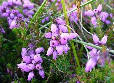
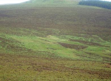
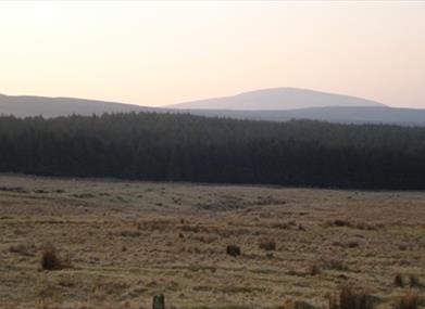
This quality accredited 5.5miles walk is the longer of the two walks that start and finish at Altarichard car park on the Altarichard Road; it is also known as the Breen Forest Walk (the other is known as The Milibern). The Trail is located within the Antrim Coast and Glens Area of Outstanding Natural Beauty. To follow this way marked trail, leave the car park and make a right turn. After a short distance you will see red and blue way marks on your left. Follow the red arrows for the Breen Forest Trail. These will lead you uphill to the summit of Croaghan from which there are outstanding panoramic views. Continue to follow the red arrows, which descend into Breen Forest, following the Moyle Way for a short section. The Trail then leaves Breen and crosses an area of upland heath before entering the final section at Altarichard Forest. On leaving the Forest make a right turn along Altarichard Road back to the car park.

Distance:
6.5 miles

Terrain:
Open hillside and forest track

Point of interest:
Panoramic views of Rathlin Island from Croaghan

Facilities:
Car park and viewing area.


Nearest town:
Magherahoney Village

OS map:
Sheet 5

Accessible terrain:
A trail across open hillside - bog and heather linking with forest roads.

Book Tickets

Facilities

Provider Preferences

  • Free (parking charges may apply)

Map & Directions

Opening Times

* Croaghan Way will be closed from Monday 21st March 22 to protect ground nesting birds.

What's Nearby

  1. A traditional Irish sheep farm experience in County Antrim. Get an insight into sheepdog…

    3.31 miles away
  2. This beautiful avenue of beech trees was planted by the Stuart family in the eighteenth…

    6.01 miles away
  3. A lonely and mysterious Moorland Lake, sometimes called the 'Vanishing Lake'.

    6.62 miles away
  4. Remains of Franciscan friary founded around 1500 by Rory MacQuillan. East range of…

    7.1 miles away
  5. We specialise in producing smoked foods naturally, in the picturesque coastal town of…

    7.2 miles away
  6. Glenariff, the Queen of the Glens, is one of the nine Antrim Glens in Northern Ireland.…

    7.24 miles away
  7. Ballycastle Beach offers stunning views of Rathlin Island and Fairhead and is…

    7.49 miles away
  8. Located one mile from Cushendall are the delightful ruins of a 13th century Franciscan…

    7.6 miles away
  9. The beautifully restored Old Church Centre offers arts & heritage events, exhibitions,…

    8.02 miles away
  10. Kinbane Castle is a Historic Monument sited in the townland of Cregganboy, located along…

    9.19 miles away
  11. This vantage point looks out over several islands, namely Rathlin, Carrick-a-rede and…

    9.89 miles away
  12. Rosepark Farm is a family run attraction spread over 70 acres, situated in the North…

    10.27 miles away
  13. Carrick-a-Rede one of Northern Ireland’s most loved attractions in Northern Ireland,…

    10.32 miles away
  14. A pleasant urban 40-acre Park in the heart of Ballymoney Town, in which to enjoy a…

    10.69 miles away
  15. In this beautiful setting visitors have time to reflect on the unprecedented achievements…

    11.05 miles away
  16. From the Mesolithic to Motorcycles, through rebellion and war, politics, industry, sport…

    11.1 miles away

Virtual Tour

Map & Directions

Road Directions

Located at the Altarichard car park/viewing area on the Orra Scenic Drive between Magherahoney and Cushendall/Cushendun.

Back to Top

Tourism Northern Ireland

Don't Miss