Official travel trade website for Northern Ireland
En

Killard National Nature Reserve

Co Down
Killard National Nature Reserve

Book Tickets Online

About

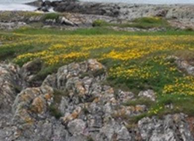
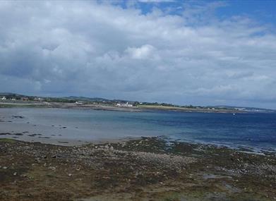
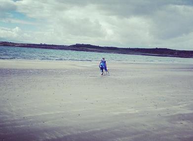
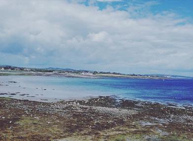
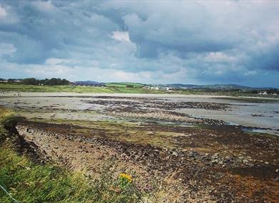
Situated at the mouth of Strangford Lough, opposite Ballyquintin. The rich wildlife include orchids and other rarities, and interesting rock formations can be seen.

Start Point:
J604434

Finish Point:
J604434

Route:
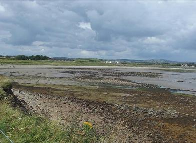
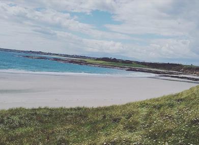
From the layby at Mill Quarter Bay, walk towards the shore. Keeping the sea on the left follow the line of the coast around the headline. A sandy bay marks the end of the walk, turn and retrace your steps along the shore or over the grassland to Mill Quarter Bay.

Distance:
1.3 miles

Terrain:
Coastal grassland, beach

Point of interest:
Views of Lough and Sea, orchids

Facilities:
None

Publication:
None

Nearest town:
Strangford

OS map:
Sheet 21

Accessible terrain:
Off road unsurfaced paths - beach and fields

Facilities

Provider Preferences

  • Free (parking charges may apply)

Map & Directions

What's Nearby

  1. Kilclief Castle was built between 1413 and 1441, reputedly by John Sely, bishop of Down.…

    1.52 miles away
  2. Ballyquintin Nature Reserve includes Ballyquintin Point at the tip of the Ards Peninsula,…

    1.87 miles away
  3. Cloghy Rocks is a wonderful location as a number of seals are often spotted here. There…

    2.4 miles away
  1. The church at St Cooey’s Wells is thought to date from the 7th century but only the…

    2.87 miles away
  2. Discover a place of contrasts and creativity at Castle Ward, an eccentric 18th century…

    4.13 miles away
  3. Situated on the hill south east of the town below the stump of Portaferry Windmill, a lay…

    4.4 miles away
  4. Portaferry Castle is a 16th Century tower-house, built by the Savage family. It is…

    4.67 miles away
  5. Enjoy a diver's view of marine life from around the world without getting wet. An…

    4.68 miles away
  6. The castle dates probably from around the 15th century, but the early history is unknown.…

    4.76 miles away
  7. Restored ruins of a sixth century church of St. Tassach, said to have given the last…

    4.85 miles away
  8. These ruined churches are situated one and a half miles north east of Portaferry on the…

    5.55 miles away
  9. Struell Wells was built around a stream flowing through a secluded valley. It was a…

    5.82 miles away
  10. Owned by the National Trust, it is a picturesque 18th century fishing village with scenic…

    5.88 miles away
  11. Two miles outside Downpatrick is the replica of St Patrick's first church in Ireland.…

    6.19 miles away
  12. The Reserve provides a relaxing natural retreat and offers visitors tranquil riverside…

    7.1 miles away
  13. Built 1954 to the designs of S. McIlveen of Ferguson and McIlveen, Belfast. This is a…

    7.24 miles away
Previous Next

Map & Directions

Road Directions

Take the Shore road out of Strangford. Cars may be left at lay-bys at Mill Quarter Bay.

Public Transport Directions

Translink - journeyplanner.translink.co.uk

Recently Viewed

  1. Bramble Green

    Type

    Arts & Crafts Shop

    Bramble Green – Sustainable Irish Knitwear is a family run knitwear business  based near the famous…

  2. Castle Archdale Yellow Route

    Type

    Walking & Hiking

    One of a variety of walks along the lough shore passing the deer park enclosure, wildfowl ponds,…

  3. Harry's Restaurant

    Type

    Restaurant

    Situated in the heart of the Nine Glens of Antrim serving the finest sustainable local seafood and…

  4. Home

    Type

    Restaurant

    Originally conceived as a pop-up restaurant, Home moved from its last address to set up permanently…

Back to Top

Tourism Northern Ireland

Don't Miss