


Book Tickets Online
About
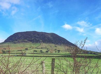
Aside from its natural beauty, Slemish's value as a heritage site is entirely bound up with its association with Saint Patrick. In local tradition, the mountain was the site of the saint's slavery, where he spent 6 years herding livestock for Mulchi, the local chieftain.
Start Point:
D217056
Finish Point:
D217056
Route:
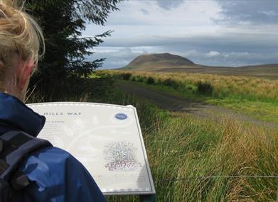
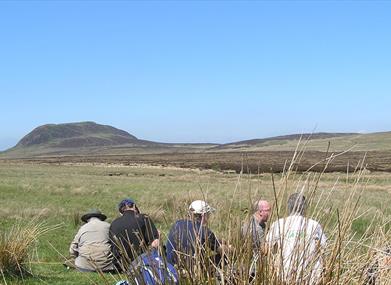
• This route begins at Slemish Car Park about 15 minutes drive from the village of Broughshane.
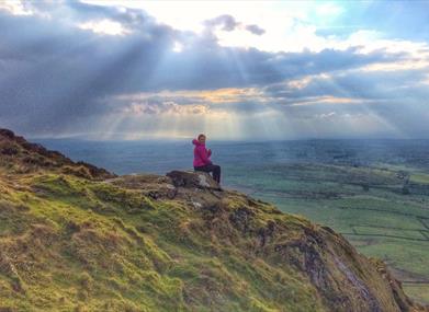
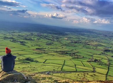
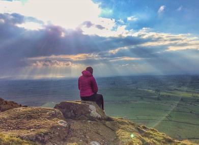
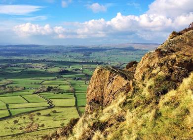
• After following a grassy track to the base of the mountain, walkers can then pick and choose their own path over rocky terrain to the summit, some 1437 feet above sea level. This short ascent is reasonably strenuous however your efforts are more than rewarded with fabulous views which are sure to re-energise any tired legs.
• For a gentler descent,...Read More
About
Aside from its natural beauty, Slemish's value as a heritage site is entirely bound up with its association with Saint Patrick. In local tradition, the mountain was the site of the saint's slavery, where he spent 6 years herding livestock for Mulchi, the local chieftain.
Start Point:
D217056
Finish Point:
D217056
Route:
• This route begins at Slemish Car Park about 15 minutes drive from the village of Broughshane.
• After following a grassy track to the base of the mountain, walkers can then pick and choose their own path over rocky terrain to the summit, some 1437 feet above sea level. This short ascent is reasonably strenuous however your efforts are more than rewarded with fabulous views which are sure to re-energise any tired legs.
• For a gentler descent, walk across the grassy summit in a southerly direction and hike down the south face of Slemish. You can then traverse back across the south western side of the mountain before picking up the route back to the car park.
Be sure to keep your eyes peeled for Irish Hares in the surrounding plains and bird lovers will enjoy spotting any number of Wheatears, Ravens and Buzzards hovering above. Despite being only 1.2 miles in length this rocky ramble should take around an hour to complete, leaving plenty of time to take in the jaw-dropping views.
Distance:
1.2 miles
Terrain:
Steep rocky track
Points of interest:
Look out for Wheater, Irish hare, Buzzard & Ravens
Facilities:
Car parking, picnic tables, toilets and information centre.
Nearest town:
Nearest village Buckna
OS map:
Sheet 9
Accessible toilet facilities:
Yes
Accessible terrain:
Steep rocky track off road
Accessible signage:
No
Facilities
Provider Preferences
- Free (parking charges may apply)


