Official travel trade website for Northern Ireland
En

The Narnia Trail

Kilbroney Park, Shore Road, Rostrevor, County Down, BT34 3AA
The Narnia Trail

Book Tickets Online

About

This family loop trail takes you through woodland at Kilbroney Park in Rostrevor. The famous writer, C S Lewis, as a young boy, spent much holiday time in the Mournes and Rostrevor in particular, allowing him to imagine, dream and wonder, and inspiring his creation of the magical world of Narnia. ‘The Chronicles of Narnia’ have sold over 100 million copies.  Lewis is reported to have written a letter to his brother saying:

“That part of Rostrevor which overlooks Carlingford Lough is my idea of Narnia”

This family trail seeks to capture the imagination of children of all ages.

Start Point:
J184179

Finish Point:
J184179

Route:
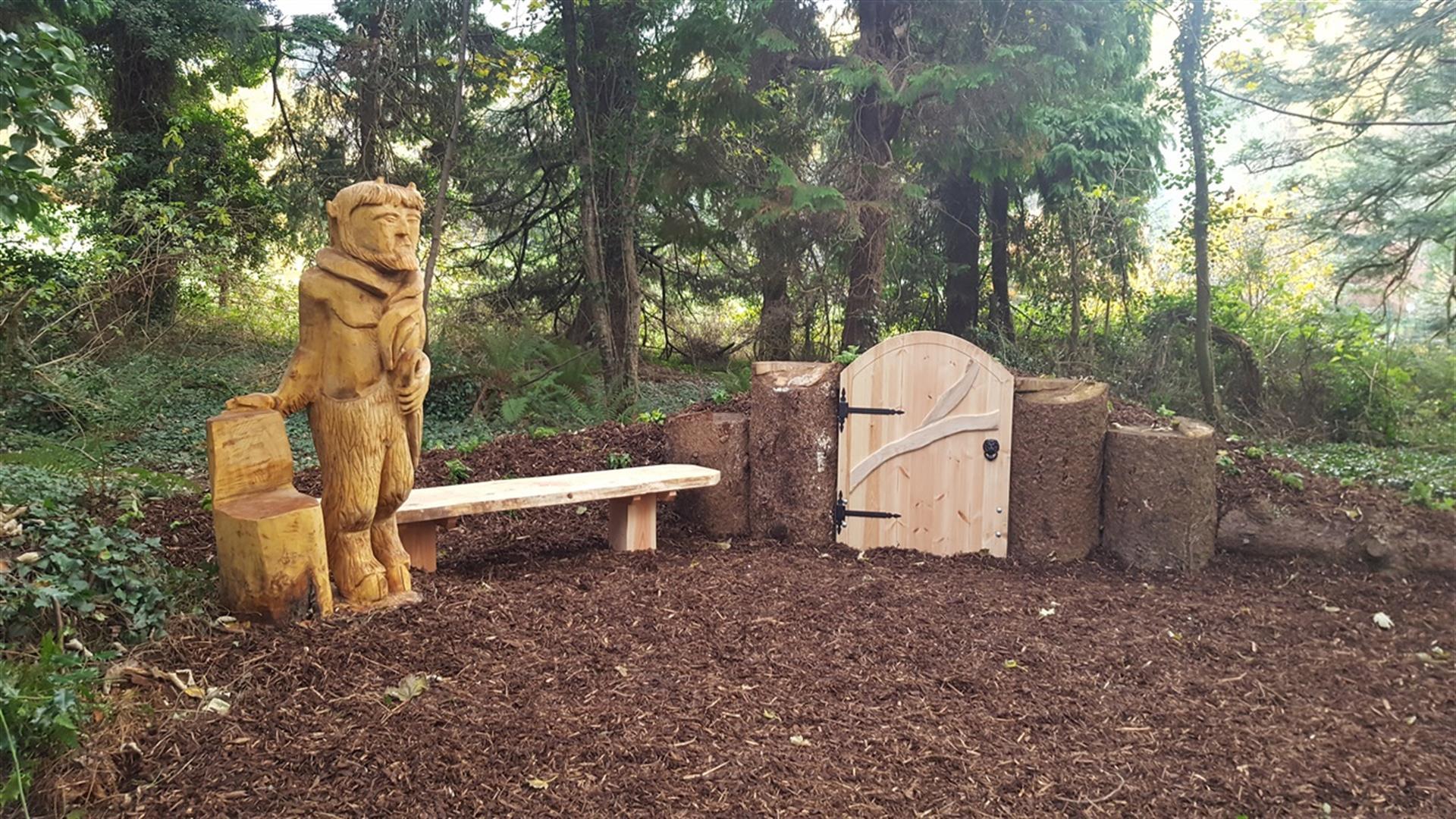
The walk starts and finishes within Kilbroney Park in Rostrevor and brings to life the Chronicles of Narnia with a number of features along the route. The trail is entered, like the magical world of Narnia itself, through a ‘Wardrobe Door’, beyond which lies a land filled with strange and intriguing creatures. Enter at your peril, as the White Witch has put a curse on the land. It is always winter and never Christmas – and she can turn you into stone. Be warned, don’t eat any “enchanted” Turkish Delight! Other features along the way include ‘The Lamp Post’, ‘The Beaver’s House’ and ‘Aslan’s Table’. These features offer many opportunities to interact and take photos/selfies.

Distance:
0.5 miles miles

Terrain:
flat woodland, gentle inclines

Point of interest:
Narnia Sculptures and features including a maze

Facilities:
The following facilities are available are available for users with limited mobility: Cafe (wheelchair accessible) Disabled toilets Disabled parking

Publication:
Visit Mourne Mountains Publication 'The Narnia & Cloughmore Trails'

Publication availability:
Available online.

Nearest town:
Rostrevor, Warrenpoint, Newry

OS map:
Mourne Outdoor Pursuits Map 1:25,000 and 1:50,000 Sheet 29

Add The Narnia Trail to your Itinerary

Map & Directions

What's Nearby

  1. Kilbroney Park Forest features riverside walks and an arboretum. There is a two-mile…

    0.11 miles away
  2. 'Cill Bhronaigh', or Bronagh’s Church (12th century), is located in the graveyard just…

    0.99 miles away
  3. Excellent example of a tower-house and bawn built about 1568 at a point where the Newry…

    3.74 miles away
  1. "Where the Mountains of Mourne sweep down to the sea" (Percy French) The popular song has…

    4.38 miles away
  2. Known locally as the ‘King’s Ring’, this court tomb has a prominent position in the…

    5.38 miles away
  3. Commanding the mouth of Carlingford Lough, the Castle has an eventful history. It was…

    5.43 miles away
  4. Cranfield West offers a gently sloping, mainly sandy beach located at the entrance to…

    6.71 miles away
  5. The Silent Valley Reservoir was built to gather water from the Mourne Mountains and is…

    7.77 miles away
  6. Kilnassagart Inscribed Stone, in the south of County Armagh, is regarded as being one of…

    7.83 miles away
  7. Bagenal’s Castle located in historic Newry is a 16th century fortified house and…

    7.88 miles away
  8. This is undoubtedly the most commanding building in Newry and is arguably the most…

    8.01 miles away
  9. South of the County Armagh village of Jonesborough lie the ruins of Moyry Castle, built…

    8.11 miles away
  10. Provides a first class service for visitors to Northern Ireland and for local residents.

    8.13 miles away
  11. The Nautilus Centre overlooks Kilkeel's busy and picturesque fishing port and houses the…

    8.24 miles away
  12. This monument is an extremely well preserved Neolithic burial site with three chambers. …

    8.26 miles away
  13. This unusual megalithic monument is set on the eastern edge of a low ridge, overlooked by…

    8.73 miles away
Previous Next

Map & Directions

Public Transport Directions

Translink - journeyplanner.translink.co.uk

Back to Top

Tourism Northern Ireland

Don't Miss