Official travel trade website for Northern Ireland
En

Killevy (Killeavy) Old Churches

Church Road, Killeavy, County Armagh, BT35 8LF
Killevy (Killeavy) Old Churches

Book Tickets Online

About

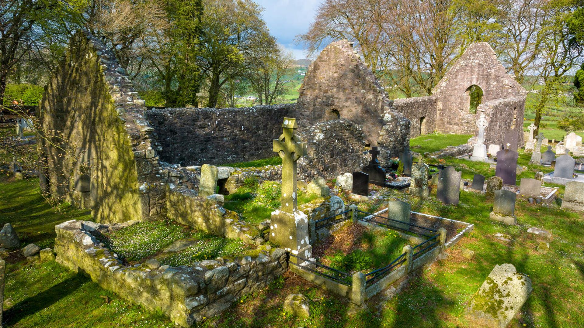
This site at the foot of Slieve Gullion contains back to back churches; the West Church dates from 11th Century and the East Church from 15th Century. It is also the site of an early monastery founded by St. Moninna in 517 as one of the most important monasteries for nuns in Medieval Ireland.

Moninna's real name was Darerca and it would appear that she came from the Donaghmore area of County Down, between Newry and Banbridge. As there were no converts in the area, Monnina went to the west of Ireland to join St. Ibar. When Ibar moved to Wexford, Monnina followed him, but stopped off with St. Brigid in Kildare.

This may have been the turning point in her life. Monnina travelled to Faughart in County Louth, Brigid’s birthplace, where she lived for some time. She then moved a short distance to Killevey, where she founded her main monastery, Cill Sleibhe Cuilinn, The Church of Slieve Gullion or Killevey, in this mountainous country of south Armagh.

Although plundered by the Vikings in 923, monastic life continued and the site was occupied by the Augustinian Nuns until 1542. The church ruins now on the site comprise two distinct churches joined lengthwise. The smaller and older is characterised by a most impressive, low lintel doorway built of three massive shaped granite stones. The more recent building, an Augustinian Convent, has a very impressive arched window with angel carvings still visible on its outside. The large tree-lined graveyard is still in use today.

Closeby is a large granite slab which is reputed to mark Monnina’s grave, with a holy well further up the hill which is still visited by pilgrims on her feast day, July 6th.

Add Killevy (Killeavy) Old Churches to your Itinerary

Close window

Call direct on:

Tel+44 (0) 28 9082 3207

Map & Directions

Opening Times

* Open access always.

What's Nearby

  1. This unusual megalithic monument is set on the eastern edge of a low ridge, overlooked by…

    0.97 miles away
  2. Slieve Gullion is Ireland's Mountain of Mystery. The Forest Park offers walking trails,…

    1.87 miles away
  3. This monument is an extremely well preserved Neolithic burial site with three chambers. …

    1.99 miles away
  1. This Neolithic burial site, dated between 4000 and 2500 BC, has a huge capstone,…

    2.82 miles away
  2. A National Trust Property, Derrymore House is an elegant thatched cottage that stands…

    3.77 miles away
  3. Bagenal’s Castle located in historic Newry is a 16th century fortified house and…

    3.87 miles away
  4. This is undoubtedly the most commanding building in Newry and is arguably the most…

    3.88 miles away
  5. Known locally as the ‘King’s Ring’, this court tomb has a prominent position in the…

    3.98 miles away
  6. This 18 arch viaduct, close to Newry, is a prominent feature of the south Armagh…

    4.29 miles away
  7. Kilnassagart Inscribed Stone, in the south of County Armagh, is regarded as being one of…

    4.65 miles away
  8. South of the County Armagh village of Jonesborough lie the ruins of Moyry Castle, built…

    4.73 miles away
  9. Excellent example of a tower-house and bawn built about 1568 at a point where the Newry…

    5.55 miles away
  10. The court tomb at Annaghmare is one of the best preserved examples of its type, with many…

    8.77 miles away
  11. Kilbroney Park Forest features riverside walks and an arboretum. There is a two-mile…

    9.28 miles away
  12. 'Cill Bhronaigh', or Bronagh’s Church (12th century), is located in the graveyard just…

    9.3 miles away
  13. "Where the Mountains of Mourne sweep down to the sea" (Percy French) The popular song has…

    10.44 miles away
Previous Next

Map & Directions

Road Directions

Directions from Town:Off B113, 3.5 miles southwest of Newry.

Back to Top

Tourism Northern Ireland

Don't Miss